DRONE DEPLOY

Boiseaerialdroneconstruction

Monitor Your Construction Progress With DroneDeploy | Boise, ID

──
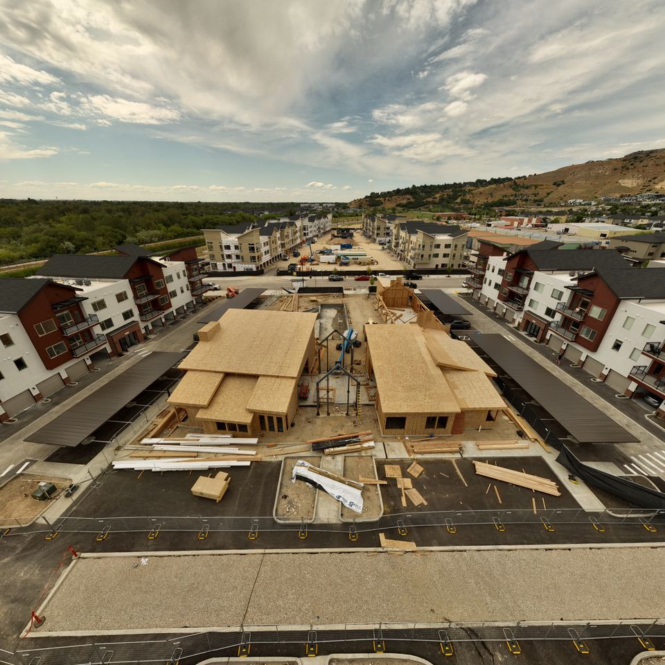
Technology in construction site management is evolving rapidly—and Boise Aerial Drone Photography is at the forefront with DroneDeploy. This cutting-edge platform revolutionizes how project teams monitor and manage construction progress.
 
Schedule Your Consultation Today


Daily Reality Capture: See Your Site in Real Time

──
Using DroneDeploy, we provide clients with a centralized platform for viewing all reality capture data, including:
  • High-resolution daily site images
     
  • Complete site surveys with a single drone flight
     
  • Orthomosaic maps (detailed, geo-referenced 2D imagery)
     
  • Elevation mapping for accurate grading comparisons
     
  • Cut and fill analysis for tracking earthwork quantities
     
  • Thermal imaging (as applicable)
     
  • Digital 2D and 3D models
     
  • Blueprint and design overlay tools
     
  • Stockpile analysis
     
  • Drone + 360° camera integration for full site views
Our team uses the DJI Mavic Air 2s to capture crisp, 20MP aerial photos—perfect for monitoring and marketing alike.

Integrated With Your Workflow

DroneDeploy connects with popular platforms like Procore and Autodesk BIM360 for seamless construction reporting and collaboration. You can:
  • Share progress reports with a click
     
  • Keep subcontractors accountable
     
  • Flag safety or compliance concerns in real time

This integration keeps your entire team aligned and your documentation streamlined.


Identify & Prevent Problems Early

Every construction project faces problems and challenges along the way. With DroneDeploy, potential issues are detected early, allowing project managers and supervisors to:
  • Flag concerns directly within the virtual inspection tools
     
  • Notify subcontractors or crews in real time
     
  • Compare aerial data with current site conditions
     
  • Prevent costly delays or rework
     
By visualizing your project in both macro and micro detail, you’ll stay on track and reduce risk throughout the build process.


Document Progress and Market Your Work

The high-resolution visuals we provide—captured with a 20MP camera—are perfect for more than just internal monitoring. Use your imagery to:
Each flight adds value to your internal documentation and your public-facing brand.


Why Drone Monitoring Makes Business Sense

Implementing regular drone mapping and photography—whether on a daily or three-times-a-week basis—offers measurable advantages:
  • Enhanced Monitoring: Gain frequent, up-to-date imagery to identify and solve problems quickly.
     
  • Improved Accuracy: Our drones provide pinpoint GPS precision, supporting better resource allocation and plan alignment.
     
  • Labor & Cost Savings: Traditional site inspections are time-consuming. Drones handle this with greater speed and fewer resources.
     
  • Better Communication: Visual data makes it easier to communicate with clients, investors, and subcontractors.
     
  • Greater Safety: Eliminate the need for workers in high-risk zones with remote inspections and monitoring.


Service Areas

Boise Aerial Drone Photography proudly serves the greater Boise, ID area, including Nampa, Meridian, Eagle, Kuna, and Mountain Home. As a local, veteran-owned business, we’re committed to providing top-tier service with integrity and precision.
 

Start Tracking Smarter

Ready to bring your construction monitoring into the future? Contact Boise Aerial Drone Photography today for a customized DroneDeploy quote.
Call (208) 912-2963 now or visit our contact page.
Schedule a Consultation

Contact Josh Today

Send  a message using the form below.
 

🇺🇸 VETERAN OWNED BUSINESS 🇺🇸