CONSTRUCTION SURVEY

.
Boisedrone 1

Drone Surveying for Construction: Accurate Data. Zero Guesswork.

──

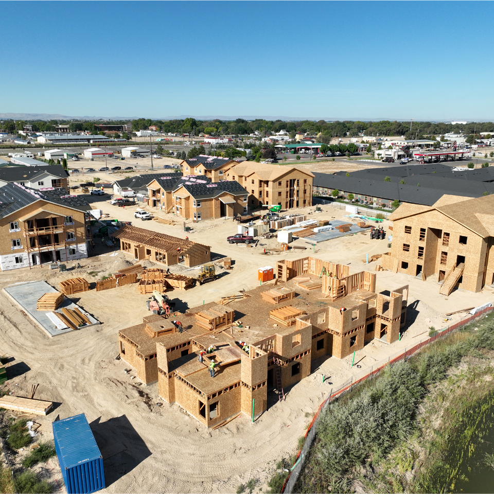
Stop walking the site just to find out what’s already gone wrong.

Our Boise-based drone surveying services give you consistent, high-resolution updates for your project, so you can spot problems before they cost you time or money. Whether you want daily updates or just need a flight every few days, we’ll deliver visuals and maps that actually help you manage the job instead of only responding to disasters.

Why Drone Surveys Work Better on the Job Site

You don’t need to replace your survey crew—you just need faster, clearer insights between benchmarks. Drone surveys by Boise Aerial Drone Photography fill the gaps without slowing anyone down.

What you get:

  • Aerial progress photos and videos, updated daily or weekly
     
  • 2D orthomosaic maps and 3D models aligned to your timeline
     
  • Site conditions tracked over time, from grading to final punch
     
  • Easy-to-share visuals for GCs, subs, and owners
     
You get a clean, accurate view of what’s happening. Not two weeks ago. Today.

Schedule a Consultation

Track, Document, and Share Construction Surveys Easily

We capture what’s done, what’s behind, and what’s going wrong, and give you the files to prove it. Our drone surveys make it easy to spot material delays or schedule slips early, so you can take action before they snowball.

We document each phase of construction—whether it’s concrete pours, steelwork, HVAC, or MEP—so you always have a visual record. You’ll also get a clear timeline of progress that’s easy to share with owners, investors, or insurance reps.

By giving everyone the same visual reference, we help cut down on miscommunication between trades and vendors. If you’ve ever wished you could rewind the jobsite, this is the next best thing.

360° Walkthroughs & Aerial Documentation for Construction Sites

Along with our drone maps, we offer 360-degree ground-level walkthroughs that capture your site like a digital tour.

These walkthroughs are ideal for remote team visibility, keeping stakeholders informed without stepping on-site. They’re also perfect for owner updates, verifying contractor work before payout, and maintaining compliance, safety, and legal documentation. 

It’s a full-picture record of the build—no extra fieldwork required.

Built for Construction. Backed by Experience.

We’ve worked job sites from Boise to Los Angeles for clients like Simplot, W&W Steel, Top Golf, and Suntec. Our team—including drone pilots, photographers, and cinematographers—brings over 95 years of combined experience, rooted in both commercial precision and creative storytelling.

We support every stage of construction, from pre-construction and earthwork verification to mid-project tracking, issue flagging, and final as-built surveys. Our work includes FAA-compliant flight planning and detailed reporting, so you stay covered from day one through turnover, with expertise you can rely on at every step.

Straightforward Pricing. Custom Packages. No Surprises.

We offer flight packages built around your project—not ours. Whether you’re managing a build in Boise or overseeing multiple sites across the region, we’ve got you covered with:

 
  • Custom deliverables (maps, video, models, walkthroughs)
     
  • Always FAA-compliant, always site-safe operations
     
  • Competitive pricing—we’ll beat any competitor’s rate
     

Let’s Get Eyes on Your Site

Keep your crew. Get better data with less time chasing it.
Ready to see how drone surveying can keep your build on time and under control? Let’s talk.
Call (208) 912-2963 or visit our
contact page to request a flight, or get a quote that fits your Boise project schedule. 
Schedule a Consultation

Contact Josh Today

Send  a message using the form below.
 

🇺🇸 VETERAN OWNED BUSINESS 🇺🇸